Take a Hike! Explore the Verona Segment of the Ice Age Trail
The Verona segment of the Ice Age Trail offers a fantastic mix of natural beauty, history, and accessibility. Whether you're looking for a quick nature escape or an extended adventure, this trail is perfect for hikers of all skill levels!
Why Hike the Verona Segment?
1. Glacial History
The Ice Age Trail follows the path of the last glacial retreat in Wisconsin (about 12,000 years ago). The Verona segment showcases unique glacial features like rolling hills, eskers, and kettle moraine terrain—a true walk through ancient history!
2. Scenic Variety
This trail offers a diverse landscape, winding through prairies, woodlands, and wetlands.
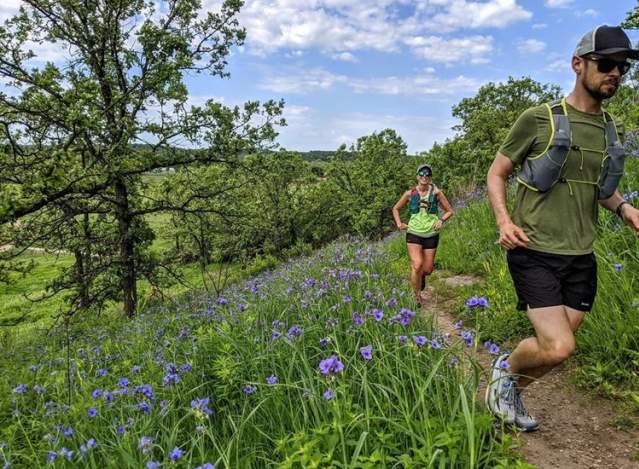
- Pass through Badger Prairie County Park, where open meadows come alive with wildflowers in warmer months.
3. Urban-Nature Blend
Unlike some remote segments of the Ice Age Trail, this section is easily accessible from Verona, making it a great day-hike option while still offering a peaceful, immersive nature experience.
4. Wildlife Hotspot
Keep your eyes open for:
- Deer, wild turkeys, and sandhill cranes
- Red-tailed hawks soaring overhead
- Foxes or coyotes (if you're lucky, especially at dawn or dusk!)
5. Perfect for All Skill Levels
- Gentle rolling hills make it ideal for beginners.
- Enough elevation changes to keep things interesting for seasoned hikers.
- A popular trail running route due to its well-maintained paths.
6. Part of a Larger System
This segment connects with the Montrose segment (southwest) and the Madison segment (northeast), offering options for extended hikes.
Suggested Day Hike on the Verona Ice Age Trail
📍 Starting Point: Ice Age Junction Area Parking Lot
- Coordinates: 42.9883, -89.5436
- Located off County Highway PB, this trailhead offers ample parking and easy access.
🚶 Key Landmarks & Highlights
1. Badger Prairie County Park (~1 mile in)
- Start your hike through open prairie with rolling hills.
- In spring and summer, enjoy wildflowers; in fall, golden grasses take over.
- A great spot to see hawks, sandhill cranes, and deer.
2. Woodland Stretch (~1.5 miles in)
- The landscape shifts into a mature oak and hickory forest.
- A shady, peaceful section perfect for listening to woodpeckers and songbirds.
3. Scenic Overlook & Turnaround Option (~2.5 miles in)
📍 Coordinates: 42.9850, -89.5670
- After a gradual climb, reach a scenic hilltop with views of rolling glacial terrain.
- A perfect snack break and photo opportunity!
- Option: Turn back here for a 5-mile round-trip hike.
🌿 Extended Option: Continue to Prairie Moraine County Park (~7.5 miles total)
4. Cross Military Ridge State Trail (~3 miles in)
- Descend to the Military Ridge State Trail, a popular multi-use path.
- Cross safely and continue southwest on the Ice Age Trail segment.
5. Prairie Moraine County Park (~3.75 miles in, turnaround point at ~7.5 miles total)
📍 Coordinates: 42.9680, -89.5785
- Experience stunning moraine formations, remnants of ancient glaciers.
- Prairie Moraine County Park is known for its diverse ecosystems and one of the best off-leash dog parks in the area.
- A great spot to rest, explore, and enjoy the views before heading back.
🔄 Return Trip Options
✅ Out-and-Back: Retrace your steps (~7.5 miles total).
✅ Loop Option: Use Military Ridge State Trail for a slightly different return route.
Hiker’s Tips & Local Recommendations
✅ Best Season: Spring and fall for mild weather and scenic beauty.
✅ Wildlife Watch: Hike early in the morning or late afternoon for the best sightings.
✅ Nearby Eats:
- Hop Haus Brewing Co. – Post-hike craft beers & bites
- Lake Louie Brewing – Outdoor beer garden vibes
- Alice Good – Cozy coffee and snacks
📍 Plan Your Hike Today!
For detailed trail maps, elevation info, and GPX downloads, visit the AllTrails Verona Ice Age Trail page:
➡️ AllTrails – Verona Segment


